Siquijor's Secret Beaches: 8 Secluded Shores Only Locals Know
Discover eight hidden beaches in Siquijor that most tourists never find. From limestone coves to palm-fringed stretches of white sand, this guide reveals the island's best-kept coastal secrets.
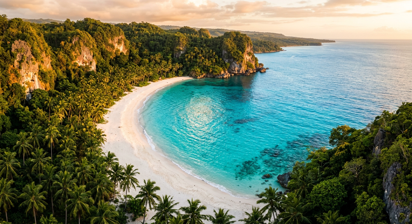
Siquijor has earned its reputation as a mystical island, but its coastline holds secrets that go beyond folklore. While most visitors flock to Paliton Beach for sunset photos or Salagdoong for cliff jumping, the island’s 102 kilometers of shoreline conceal dozens of quiet coves, rocky inlets, and pristine stretches of sand that see barely a handful of visitors each week.
This guide maps out eight of the most secluded beaches in Siquijor. Some require a short hike, others a boat ride, and a few are hiding in plain sight along the main coastal road. All of them reward the curious traveler with solitude, clear water, and the kind of unhurried atmosphere that first put Siquijor on the map.
1. Basak Beach, San Juan
Basak sits just north of the more popular Solangon Beach, but a rocky headland separates the two and keeps foot traffic to a minimum. The beach is a narrow crescent of coarse white sand backed by coconut palms and a handful of modest fishing huts. There is no resort frontage here, no beach bar, and no loungers for rent.
The water is shallow and calm during the dry season months of March through May, making it suitable for wading and snorkeling close to shore. A small reef flat extends about thirty meters out, where you can spot parrotfish, sea urchins, and the occasional blue starfish resting on the sandy bottom.
How to find it: From the San Juan town center, head north along the coastal road. About 800 meters past Solangon Beach, look for a narrow concrete path on your left between two residential properties. Follow it for about two minutes on foot. There is space to park one motorcycle at the entrance.
Best time to visit: Early morning, when the sun lights up the eastern-facing shore and local fishermen are just returning with their catch.
2. Nonoc Beach, Maria
The municipality of Maria occupies the northeastern corner of Siquijor, and its coastline remains one of the least developed stretches on the island. Nonoc Beach is a long, gently curving bay where the sand shifts between white and pale gold depending on the tide. Mangrove clusters frame both ends of the beach, and at low tide, shallow tidal pools form along the rocky edges.
What makes Nonoc stand apart is the view. On a clear day, you can see the outline of Cebu Island to the north and the peaks of Negros Oriental to the west. The beach faces the open Bohol Sea, so the water tends to be slightly rougher than on the western coast, but it remains swimmable during the dry season.
There are no commercial establishments on Nonoc Beach. The nearest sari-sari store is a five-minute walk inland in the small barangay center. Bring your own water and snacks.
How to find it: From Maria town proper, take the barangay road toward Nonoc. The beach is about 1.5 kilometers from the main coastal highway. Ask locals for the path to the shore if the signage is absent, which it often is.
Best time to visit: Late afternoon for golden light and cooler temperatures. Weekdays are virtually empty.
3. Cang-apa Cove, Enrique Villanueva
Tucked between two limestone outcrops on the southern coast, Cang-apa Cove is barely twenty meters wide. It feels more like a private swimming pool than a beach. The sand is fine and white, the water is impossibly clear, and the surrounding rock walls create a natural windbreak that keeps the surface glass-smooth even when the open sea beyond is choppy.
The cove sits below a low cliff, and reaching it requires descending a rough trail of about fifty steps cut into the rock. The path is not maintained and can be slippery after rain, so proper footwear is essential. Once you reach the bottom, the payoff is immediate: a sheltered pocket of turquoise water with excellent visibility for snorkeling right off the rocks.
The reef along the eastern wall of the cove is particularly healthy, with branching corals, sea fans, and small schools of damselfish and wrasse. Bring a mask and fins if you have them.
How to find it: From the Enrique Villanueva municipal hall, continue south along the coastal road for approximately three kilometers. The trailhead is unmarked but sits between kilometer markers 62 and 63. A large mango tree on the seaward side of the road marks the spot.
Best time to visit: Midday, when the sun is directly overhead and lights up the underwater landscape. The cove is shaded by the cliffs in early morning and late afternoon.
4. Caticugan Beach, Larena
Larena is where most ferries dock, and visitors typically leave the port town as quickly as possible. This means almost nobody discovers Caticugan Beach, a quiet stretch of pale sand about four kilometers south of the ferry terminal. The beach sits in a gentle bay with a view of the Larena pier in the distance and the silhouette of Cebu’s mountains across the strait.
The seafloor here is a mix of sand and seagrass, and while it is not the best snorkeling on the island, the seagrass beds support a population of sea cucumbers, small rays, and juvenile fish. Local fishermen sometimes dry their nets on the beach in the morning, adding a photogenic element that you will not find at the more curated resort beaches.
A small community of about a dozen houses lines the road behind the beach, and residents are friendly to visitors who are respectful of the space.
How to find it: From Larena port, head south on the main road. After passing the Larena public market, continue for about two kilometers and turn left at the small chapel. The beach is 300 meters down the unpaved road.
Best time to visit: Early morning or late afternoon. The beach faces west and gets excellent sunset light.
5. Tambisan Beach, Siquijor Town
Siquijor town, the provincial capital, has its own share of undervisited coastline. Tambisan Beach lies south of the town center, past the historic watchtower ruins, in a stretch where the road pulls slightly inland and the shore becomes harder to access by vehicle.
The beach is roughly 200 meters long, flanked by volcanic rock formations on one end and a grove of talisay trees on the other. The sand is a mix of white and coral fragments, and the swimming area is shallow and protected by a natural reef barrier about fifty meters offshore. This makes it one of the safest swimming spots on the island for those traveling with children.
During the amihan season from November through February, the northeast wind pushes small amounts of seaweed onto the beach, but the dry season months from March onward see clean, calm conditions.
How to find it: From the Siquijor town plaza, walk south along the coastal path past the old Spanish watchtower ruins. Continue for about ten minutes on foot. The beach opens up after the last residential cluster.
Best time to visit: Morning, when the calm water is at its clearest. Bring reef shoes for the rocky entry points at either end.
6. Balodbod Beach, Lazi
Lazi is famous for its centuries-old church and convent, but the coastline between Lazi and Maria hides some of the island’s most dramatic scenery. Balodbod Beach sits at the base of a low bluff, accessible via a winding trail through a coconut plantation.
The beach itself is about 150 meters of white sand, but what sets it apart is the rock formation at its southern end: a series of flat limestone platforms that create natural pools during medium tide. These pools are warm, shallow, and home to tiny fish, hermit crabs, and colorful sea anemones.
The bluff above the beach offers a panoramic view of the eastern coast. On clear mornings, the sunrise from this vantage point is among the finest on the island, with the sun rising directly over the Bohol Sea.
How to find it: From Lazi town center, take the coastal road east toward Maria. About three kilometers past the Lazi convent, a dirt track leads left toward the coast through a coconut grove. The walk from the road to the beach takes about eight minutes.
Best time to visit: Sunrise, if you are willing to make the pre-dawn walk. Mid-morning is also excellent for the tide pools.
7. Cang-isok Beach, San Juan
San Juan is the most popular municipality for tourists, but even here, pockets of solitude exist. Cang-isok Beach is a thin ribbon of sand at the base of a coral cliff, accessed through a private property whose owners allow respectful visitors to pass through.
The beach is only about 50 meters long, but it faces directly west with an unobstructed horizon, making it one of the best sunset-watching spots on the entire island. The cliff behind the beach is covered in morning glory vines and sea grapes, and at high tide, the water comes right up to the base of the rock, creating a dramatic meeting of stone and sea.
Snorkeling here is rewarding. The reef drops off quickly just a few meters from shore, and the deeper water beyond the shelf supports larger fish species including blue tangs, butterflyfish, and occasional reef sharks.
How to find it: From the main San Juan road, look for the small barangay sign for Cang-isok. A concrete pathway between two houses leads to the cliff edge, where a set of rough steps descends to the beach. Ask permission from the house on the right before descending.
Best time to visit: Sunset. Arrive at least thirty minutes before sundown to secure a comfortable spot and enjoy the changing light.
8. Bitaog Beach, Enrique Villanueva
Named after the bitaog trees (Calophyllum inophyllum) that line its shore, this beach occupies a quiet bay on the southern coast between Enrique Villanueva and Lazi. The bitaog trees provide natural shade across most of the beach, which means you can spend hours here without needing an umbrella or tent.
The sand is fine-grained and pale, and the water deepens gradually, making it comfortable for swimming. A small freshwater spring emerges from the rocks at the western end of the beach, and locals sometimes use it for rinsing off after swimming.
The beach sees almost no tourist traffic because it is not visible from the main road and has no signage. Even on weekends, you are unlikely to share it with more than a handful of local families who come to picnic under the bitaog trees.
How to find it: From the Enrique Villanueva town center, head east on the coastal road toward Lazi. After approximately five kilometers, watch for a cluster of bitaog trees visible from the road on the seaward side. A narrow footpath between the trees leads to the beach in about one minute.
Best time to visit: Anytime. The tree canopy provides shade throughout the day, and the bay is sheltered enough for comfortable swimming in most conditions.
Tips for Visiting Secret Beaches in Siquijor
Respect the locals. Many of these beaches are adjacent to residential areas and fishing communities. Greet residents, ask before entering private land, and keep noise levels down. A simple “Maayong buntag” (good morning) in Cebuano goes a long way.
Leave no trace. These beaches remain pristine because they see little traffic. Carry out everything you bring in, including food wrappers, bottles, and cigarette butts. Do not collect shells, coral, or sand.
Bring essentials. Most of these beaches have no nearby shops. Pack water, sunscreen (reef-safe if possible), snacks, and a basic first aid kit. Reef shoes are advisable for rocky entries.
Check the tides. Some coves and tide pools are only accessible or enjoyable at specific tide levels. The Philippine Atmospheric, Geophysical and Astronomical Services Administration (PAGASA) publishes daily tide tables for the Visayas region.
Hire a local guide. For the harder-to-find beaches, asking a local fisherman or habal-habal driver to take you is often the easiest and most rewarding approach. Expect to pay between 200 and 500 pesos depending on distance and time. The drivers know trails and shortcuts that no map application will show you.
Go early or late. Dawn and dusk are the most beautiful times on any Siquijor beach, and they are also the coolest. Midday heat can be intense from March through May, especially on beaches without tree cover.
Why These Beaches Stay Hidden
Siquijor’s tourism infrastructure is concentrated along the western coast, particularly in San Juan and along the road between Larena and Siquijor town. The eastern and southern coasts remain relatively undeveloped, partly because the terrain is rougher and partly because tourist accommodations are sparse in those areas.
This pattern is unlikely to change rapidly. The island’s municipal governments have shown a commitment to controlled development, and the absence of large-scale resort construction on the quieter coasts reflects both policy and geography. For travelers willing to rent a motorcycle and spend a day exploring, these hidden beaches represent the Siquijor that existed before the travel blogs arrived.
The island is small enough that even the most remote beach on this list is no more than forty minutes from the nearest town center by motorcycle. There is no excuse not to explore.
Siquijor.xyz Editorial Team
Local experts sharing authentic Siquijor experiences
Related Experiences
Apo Island Day Trip: Swimming with Sea Turtles
Complete guide to visiting Apo Island from Siquijor - swim with sea turtles, explore vibrant coral reefs, and experience one of the Philippines' best marine sanctuaries.

Cantabon Cave Spelunking: An Underground Adventure in Siquijor
Navigate underground rivers, squeeze through tight passages, and discover stunning rock formations in Siquijor's most thrilling cave system. Complete spelunking guide included.
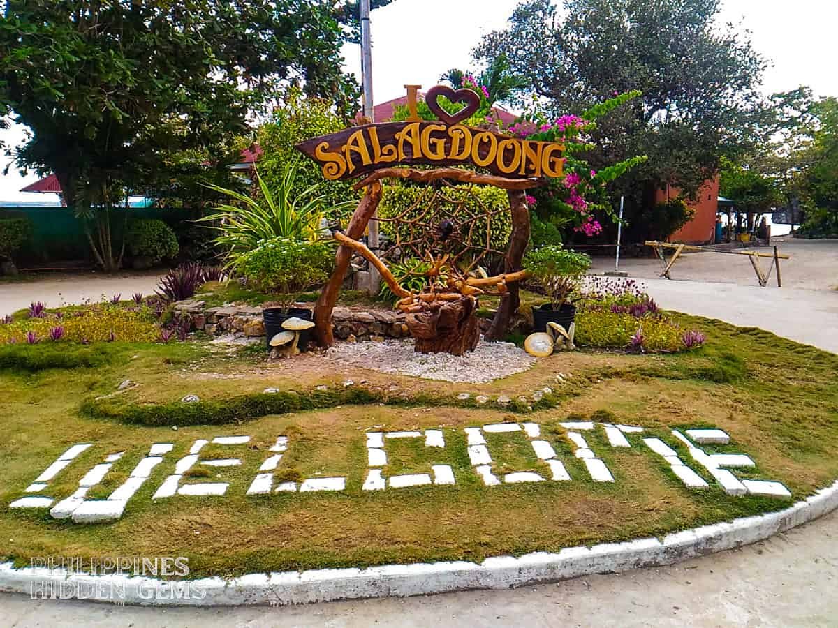
Cliff Jumping at Salagdoong Beach
Your complete guide to cliff jumping at Salagdoong Beach - Siquijor's most thrilling adventure with platforms at 5m, 8m, and 10m heights.